 We provide 3D GPS surveying equipment disCAV, made in Italy
GHS 144,100
Road construction and repair
Ukraine, Dnipro
We provide 3D GPS surveying equipment disCAV, made in Italy
GHS 144,100
Road construction and repair
Ukraine, Dnipro
3D GPS DisCAV system for grader or bulldozer made in Italy
The ad 3D GPS DisCAV system for grader or bulldozer made in Italy has been sold and is not included in the search!
Similar ads
We provide 3D GPS surveying equipment disCAV, made in Italy
GHS 144,100
Road construction and repair
Ukraine, Dnipro
Sold




1/13
Location:
Ukraine Dnipro
 Dnipro
Placed on:
more than 1 month
Machineryline ID:
JQ41420
Details:
Automatically translated from Ukrainian
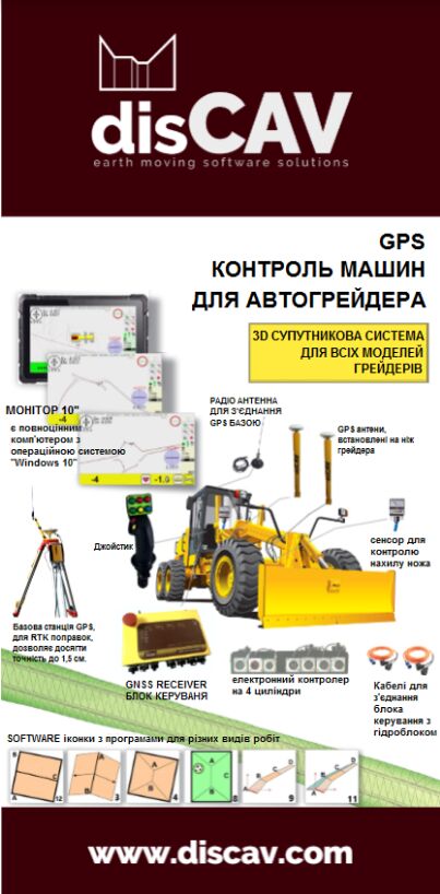
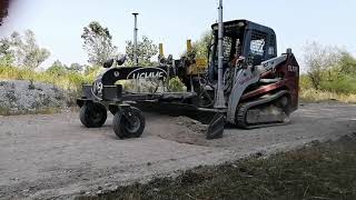
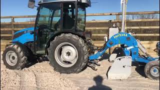
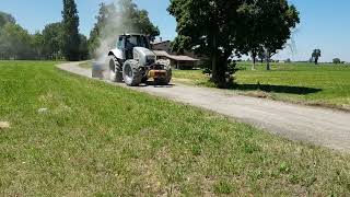
DisCAV's 3D GPS system saves time and resources. This is a satellite leveling system, installed in the cab and controls the grader in automatic or manual mode.
The height of the slope being built, the slope, the turn - the machine exactly repeats the model of the road embedded in the computer, with the Windows 10 operating system.
How it works: The grader arrives at the planned road section...
The height of the slope being built, the slope, the turn - the machine exactly repeats the model of the road embedded in the computer, with the Windows 10 operating system.
How it works: The grader arrives at the planned road section...
DisCAV's 3D GPS system saves time and resources. This is a satellite leveling system, installed in the cab and controls the grader in automatic or manual mode.
The height of the slope being built, the slope, the turn - the machine exactly repeats the model of the road embedded in the computer, with the Windows 10 operating system.
How it works: The grader arrives at the planned road section. The survey is carried out by the operator directly from the cockpit, point A (beginning) and point B (end) of the planned section is marked in the center along the road, the slope data on the edges taken from the project is kept, the on-board computer performs the necessary calculations and after a few minutes the operator can start work on site planning. 3D GPS. The project can be made in the cockpit or downloaded from "AutoCAD".
The height of the slope being built, the slope, the turn - the machine exactly repeats the model of the road embedded in the computer, with the Windows 10 operating system.
How it works: The grader arrives at the planned road section. The survey is carried out by the operator directly from the cockpit, point A (beginning) and point B (end) of the planned section is marked in the center along the road, the slope data on the edges taken from the project is kept, the on-board computer performs the necessary calculations and after a few minutes the operator can start work on site planning. 3D GPS. The project can be made in the cockpit or downloaded from "AutoCAD".
Show more
3D GPS система DisCAV позволяет экономить время и ресурсы. Это спутниковая система нивелирования, устанавливаемая в кабине и в автоматически, либо в ручном режиме управляет работой грейдера.
Высоту строящегося наклона, уклон, поворот - машина точно повторяет вложенную в компьютер, с операционной системой "Windows 10", модель дороги.
Как это работает Грейдер приезжает на запланированный участок дороги. Съемка производится оператором непосредственно из кабины, по центру вдоль дороги отмечается точка А (начало) и точку В (конец) запланированного участка, водятся данные наклонов по краям, взятые из проекта, бортовой компьютер производит необходимые вычисления и уже через несколько минут оператор может приступать к работе по планировке участка. 3D GPS. Проект можно сложить в кабине, или скачать его с "AutoCAD".
Высоту строящегося наклона, уклон, поворот - машина точно повторяет вложенную в компьютер, с операционной системой "Windows 10", модель дороги.
Как это работает Грейдер приезжает на запланированный участок дороги. Съемка производится оператором непосредственно из кабины, по центру вдоль дороги отмечается точка А (начало) и точку В (конец) запланированного участка, водятся данные наклонов по краям, взятые из проекта, бортовой компьютер производит необходимые вычисления и уже через несколько минут оператор может приступать к работе по планировке участка. 3D GPS. Проект можно сложить в кабине, или скачать его с "AutoCAD".
3D GPS система DisCAV дозволяе заощаджувати час та ресурси. Це супутникова система нівелювання, встановлюється в кабіні і в автоматично,або в ручному режимі керує роботою грейдера.
Висоту нахилу, що будується, ухил, поворот - машина точно повторює вкладену в комп'ютер, з операційною системою "Windows 10", модель дороги.
Як це працює: Грейдер приїжджає на заплановану ділянку дороги. Зйомка проводиться оператором безпосередньо з кабіни, по центру вздовж дороги відзначається точка А (початок) і точку В (кінець) запланованої ділянки, водяться дані нахилів по краях, взяті з проекту, бортовий комп'ютер проводить необхідні обчислення і вже через кілька хвилин оператор може приступати до роботу з планування ділянки. 3D GPS. Проект можна скласти в кабіні, або завантажити його з "AutoCAD ".
Висоту нахилу, що будується, ухил, поворот - машина точно повторює вкладену в комп'ютер, з операційною системою "Windows 10", модель дороги.
Як це працює: Грейдер приїжджає на заплановану ділянку дороги. Зйомка проводиться оператором безпосередньо з кабіни, по центру вздовж дороги відзначається точка А (початок) і точку В (кінець) запланованої ділянки, водяться дані нахилів по краях, взяті з проекту, бортовий комп'ютер проводить необхідні обчислення і вже через кілька хвилин оператор може приступати до роботу з планування ділянки. 3D GPS. Проект можна скласти в кабіні, або завантажити його з "AutoCAD ".

Road construction and repairs
Search results:
1 ad